Berkas:Europe 1360.jpg
Ukuran pratayang ini: 800 × 493 piksel. Resolusi lainnya: 320 × 197 piksel | 640 × 394 piksel | 1.024 × 631 piksel | 1.280 × 789 piksel | 1.817 × 1.120 piksel.
Ukuran asli (1.817 × 1.120 piksel, ukuran berkas: 695 KB, tipe MIME: image/jpeg)
Ringkasan
| Deskripsi |
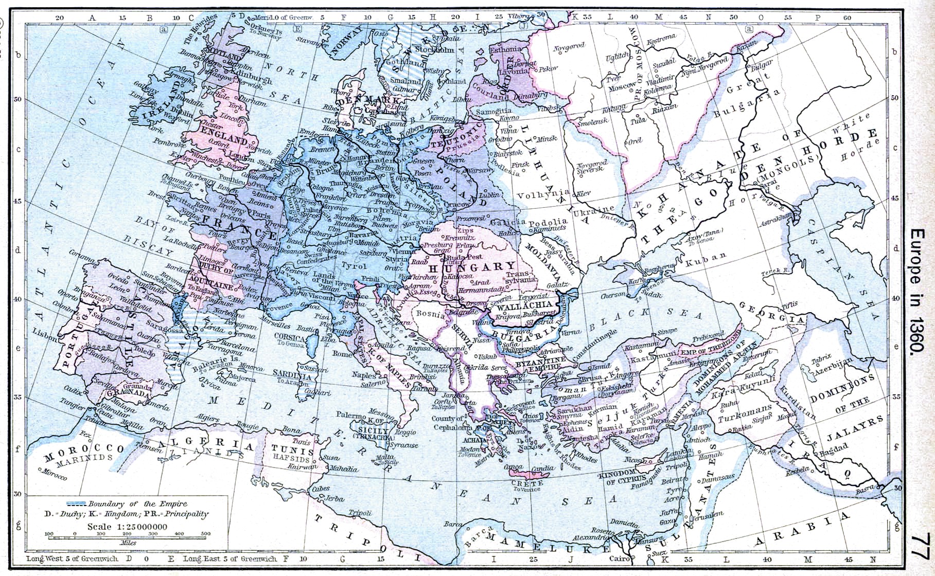
English: Europe in 1360. |
||||||||||||||||||||||
| Tanggal | |||||||||||||||||||||||
| Sumber | http://www.lib.utexas.edu/maps/historical/shepherd/europe_1360.jpg | ||||||||||||||||||||||
| Pembuat |
|
||||||||||||||||||||||
| Versi lainnya | Karya turunan dari berkas ini: | ||||||||||||||||||||||
.jpg)
_en.png)
.png)
.jpg)
Lisensi
|
The author died in 1934, so this work is in the public domain in its country of origin and other countries and areas where the copyright term is the author's life plus 80 years or fewer. Karya ini berada dalam domain publik di Amerika Serikat karena karya ini dipublikasikan (atau didaftarkan di U.S. Copyright Office) sebelum 1 Januari 1929. | |
| Berkas ini telah diidentifikasi bebas dari pembatasan menurut hukum hak cipta termasuk semua hak terkait dan relevan. | |
Riwayat berkas
Klik pada tanggal/waktu untuk melihat berkas ini pada saat tersebut.
| Tanggal/Waktu | Miniatur | Dimensi | Pengguna | Komentar | |
|---|---|---|---|---|---|
| terkini | 24 April 2009 20.51 | | 1.817 × 1.120 (695 KB) | Alex:D | contrast |
| 8 Mei 2006 10.31 |  | 1.817 × 1.120 (424 KB) | Roke~commonswiki | Europe in 1360 {{Europe}} {{PD-PCL|http://www.lib.utexas.edu/maps/historical/shepherd/europe_1360.jpg}} Category: Historical maps of Europe |
Penggunaan berkas
Halaman berikut menggunakan berkas ini:
Penggunaan berkas global
Wiki lain berikut menggunakan berkas ini:
- Penggunaan pada ar.wikipedia.org
- Penggunaan pada azb.wikipedia.org
- Penggunaan pada bg.wikipedia.org
- Penggunaan pada ca.wikipedia.org
- Penggunaan pada da.wikipedia.org
- Penggunaan pada en.wikipedia.org
- Penggunaan pada es.wikipedia.org
- Penggunaan pada fa.wikipedia.org
- Penggunaan pada fr.wikipedia.org
- Penggunaan pada hr.wikipedia.org
- Penggunaan pada hy.wikipedia.org
- Penggunaan pada it.wikipedia.org
- Penggunaan pada nl.wikipedia.org
- Penggunaan pada nrm.wikipedia.org
- Penggunaan pada pl.wikipedia.org
- Penggunaan pada scn.wikipedia.org
- Penggunaan pada sh.wikipedia.org
- Penggunaan pada sr.wikipedia.org
- Penggunaan pada vi.wikipedia.org