Berkas:Portage Wisconsin aerial view.jpg
Ukuran pratayang ini: 800 × 480 piksel. Resolusi lainnya: 320 × 192 piksel | 1.024 × 614 piksel | 1.500 × 900 piksel.
Ukuran asli (1.500 × 900 piksel, ukuran berkas: 644 KB, tipe MIME: image/jpeg)
| Deskripsi |
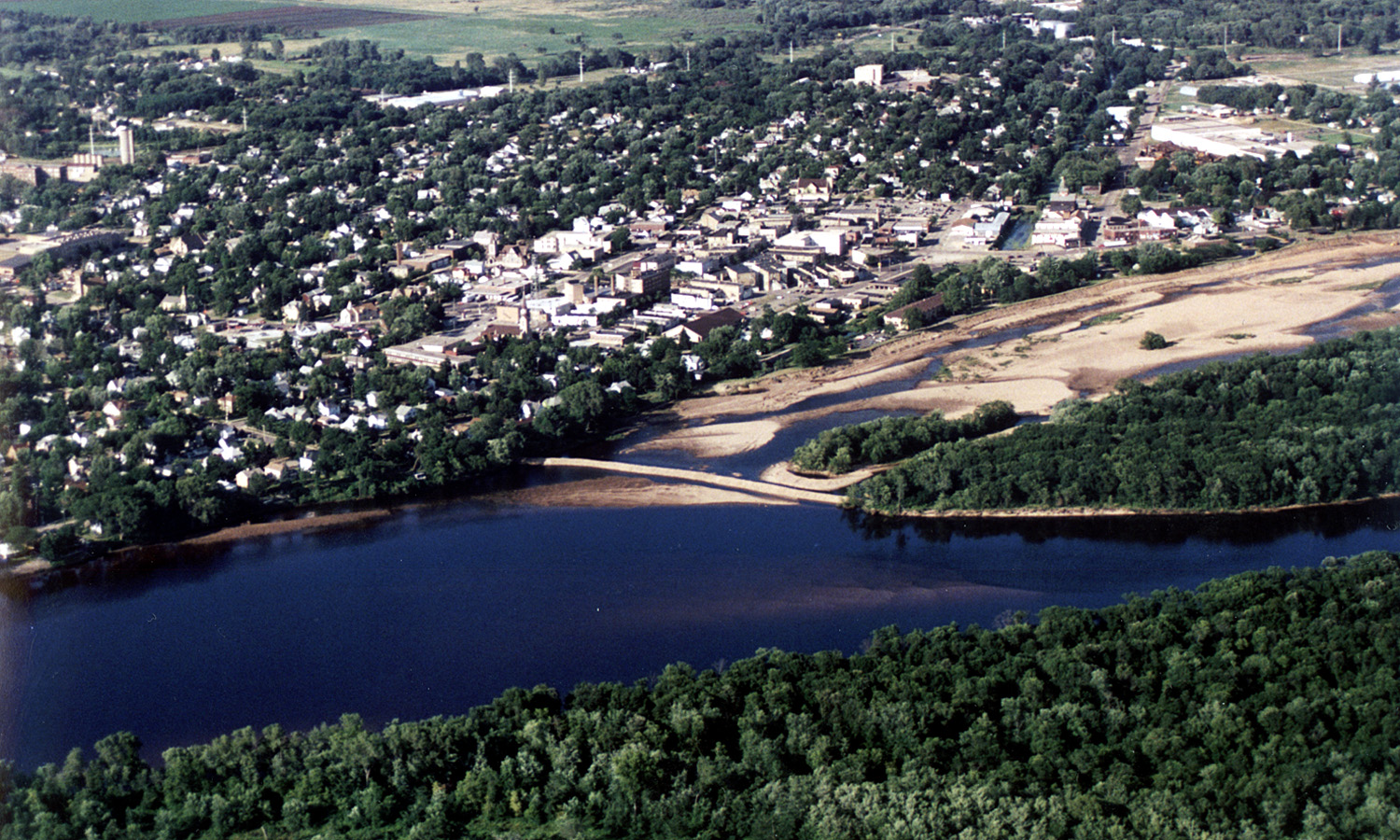
English: Aerial view of the City of Portage, Wisconsin, USA on the Wisconsin River. Upstream end of project showing cofferdam protecting river borrow area. Portage canal leading to the Fox River, visible on the right. |
|||
| Tanggal | ||||
| Sumber |
U.S. Army Corps of Engineers Digital Visual Library Image page Image description page Digital Visual Library home page |
|||
| Pembuat | Tom Crump, U.S. Army Corps of Engineers | |||
| Izin (Menggunakan kembali berkas ini) |
|
|||
| Location | Portage, Wisconsin, USA |
| Lokasi kamera | | Lihat gambar ini dan gambar di sekitarnya di: OpenStreetMap |
|---|
Riwayat berkas
Klik pada tanggal/waktu untuk melihat berkas ini pada saat tersebut.
| Tanggal/Waktu | Miniatur | Dimensi | Pengguna | Komentar | |
|---|---|---|---|---|---|
| terkini | 7 April 2007 03.15 | | 1.500 × 900 (644 KB) | DanMS | {{Information | Description = {{en|Aerial view of the City of Portage, Wisconsin, USA on the Wisconsin River. Upstream end of project showing cofferdam protecting river borrow area. Portage canal leading to the Fox River, visible on the right.}} | |
Penggunaan berkas
Halaman berikut menggunakan berkas ini:
Penggunaan berkas global
Wiki lain berikut menggunakan berkas ini:
- Penggunaan pada de.wikipedia.org
- Penggunaan pada en.wikipedia.org
- Penggunaan pada eo.wikipedia.org
- Penggunaan pada es.wikipedia.org
- Penggunaan pada fr.wikipedia.org
- Penggunaan pada mt.wikipedia.org
- Penggunaan pada simple.wikipedia.org