Berkas:Lancashire UK location map.svg

Ukuran pratayang PNG ini dari berkas SVG ini: 513 × 600 piksel Resolusi lainnya: 205 × 240 piksel | 410 × 480 piksel | 657 × 768 piksel | 876 × 1.024 piksel | 1.751 × 2.048 piksel | 1.116 × 1.305 piksel.
Ukuran asli (Berkas SVG, secara nominal 1.116 × 1.305 piksel, besar berkas: 2,3 MB)
| Deskripsi |
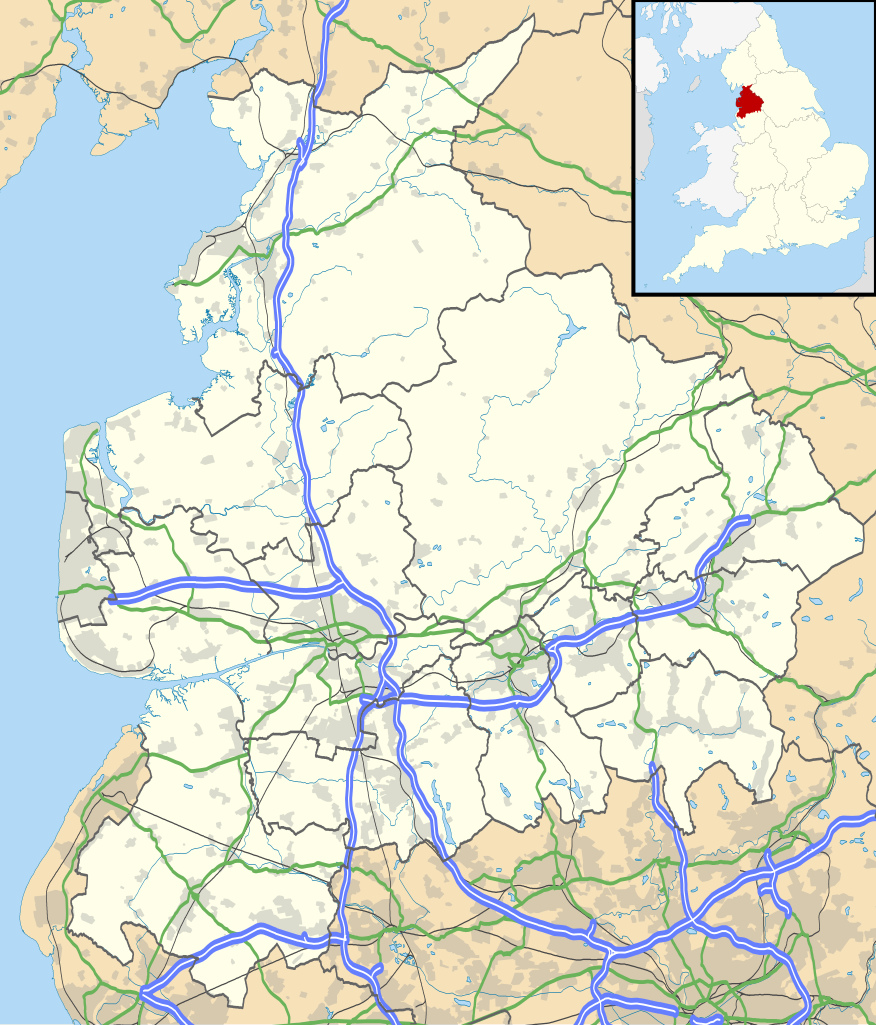
Map of Lancashire, UK with the following information shown:
Equirectangular map projection on WGS 84 datum, with N/S stretched 165% Geographic limits:
|
| Tanggal | |
| Sumber |
|
| Pembuat | Nilfanion, created using Ordnance Survey data |
| Izin (Menggunakan kembali berkas ini) |
Berkas on ipartandoan sian on Creative Commons Attribution-Share Alike 3.0 Unported partadoan. Atribusi: Contains Ordnance Survey data © Crown copyright and database right
|
| Versi lainnya | File:Lancashire UK district map (blank).svg - Blank map |
.svg)
Riwayat berkas
Klik pada tanggal/waktu untuk melihat berkas ini pada saat tersebut.
| Tanggal/Waktu | Miniatur | Dimensi | Pengguna | Komentar | |
|---|---|---|---|---|---|
| terkini | 26 September 2010 18.59 | | 1.116 × 1.305 (2,3 MB) | Nilfanion | {{Information |Description=Map of Lancashire, UK with the following information shown: *Administrative borders *Coastline, lakes and rivers *Roads and railways *Urban areas Equirectangular map projection on WGS 84 datum, with N/S stretch |
Penggunaan berkas
2 halaman berikut menggunakan berkas ini:
Penggunaan berkas global
Wiki lain berikut menggunakan berkas ini:
- Penggunaan pada ar.wikipedia.org
- Penggunaan pada bg.wikipedia.org
- Penggunaan pada ceb.wikipedia.org
- Penggunaan pada en.wikipedia.org
- Accrington
- Bacup
- Lancaster, Lancashire
- Preston, Lancashire
- Chorley
- Astley Hall, Chorley
- Blackpool
- Read, Lancashire
- Ormskirk
- Burnley
- Galgate
- Heysham
- Blackburn
- Barnoldswick
- Darwen
- Clitheroe
- Parbold
- Adlington, Lancashire
- Kirkham, Lancashire
- Lytham St Annes
- Longridge
- Poulton-le-Fylde
- Carnforth
- Reedley Hallows
- Up Holland
- Padiham
- Clayton-le-Moors
- Brierfield, Lancashire
- Oswaldtwistle
- Fleetwood
- Whalley, Lancashire
- Cleveleys
- Centre points of the United Kingdom
- Stonyhurst
- Bolton-le-Sands
- Haslingden
- River Wyre
- Lancashire Infantry Museum
- Higham, Lancashire
- Nelson, Lancashire
- Colne
- Wycoller
- Bleasdale
- Scarisbrick
- Knott End-on-Sea
- Great Altcar
- List of places in Lancashire
Lihat lebih banyak penggunaan global dari berkas ini.