Berkas:Tunisia adm location map.svg

Ukuran asli (Berkas SVG, secara nominal 378 × 743 piksel, besar berkas: 162 KB)
Ringkasan
| Deskripsi |
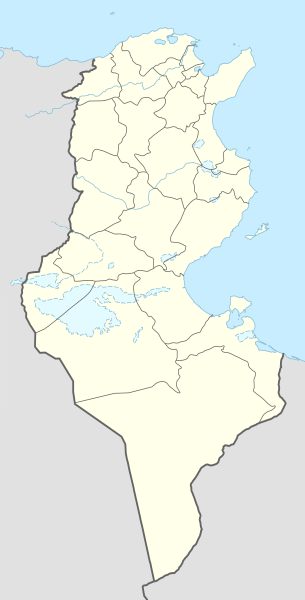
Deutsch: Positionskarte von Tunesien
English: Location map of Tunisia
|
||||||||||||
| Tanggal | |||||||||||||
| Sumber |
Own work using:
|
||||||||||||
| Pembuat | NordNordWest | ||||||||||||

|
This map has been made or improved in the German Kartenwerkstatt (Map Lab). You can propose maps to improve as well.
|
Lisensi
Usage of this file with:

explanatory notes: Legally binding is only the full legalcode. For a free usage I recommend to respect the following licence conditions:
1. Provide my name as given above: NordNordWest,
2. a copy of, or the URI for, the applicable license: https://creativecommons.org/licenses/by-sa/3.0/de/legalcode,
3. the title of the work,
4. in the case of an adaptation, a credit identifying the use of the work in the adaptation.
This license and the rights granted hereunder will terminate automatically upon any breach by you of the terms of this license. Any of the above conditions can be waived if you get permission from the copyright holder. If you have questions or wish differing conditions, please contact me through nnwest or my discussion page ![]() t-online.de
t-online.de
- Anda diizinkan:
- untuk berbagi – untuk menyalin, mendistribusikan dan memindahkan karya ini
- untuk menggubah – untuk mengadaptasi karya ini
- Berdasarkan ketentuan berikut:
- atribusi – Anda harus mencantumkan atribusi yang sesuai, memberikan pranala ke lisensi, dan memberi tahu bila ada perubahan. Anda dapat melakukannya melalui cara yang Anda inginkan, namun tidak menyatakan bahwa pemberi lisensi mendukung Anda atau penggunaan Anda.
- berbagi serupa – Apabila Anda menggubah, mengubah, atau membuat turunan dari materi ini, Anda harus menyebarluaskan kontribusi Anda di bawah lisensi yang sama seperti lisensi pada materi asli.

Riwayat berkas
Klik pada tanggal/waktu untuk melihat berkas ini pada saat tersebut.
| Tanggal/Waktu | Miniatur | Dimensi | Pengguna | Komentar | |
|---|---|---|---|---|---|
| terkini | 24 Maret 2024 12.03 | | 378 × 743 (162 KB) | GrandEscogriffe | more correct north-south stretching |
| 9 November 2014 15.59 |  | 378 × 713 (146 KB) | NordNordWest | == {{int:filedesc}} == {{Information |Description= {{de|1=Positionskarte von Tunesien}} {{en|1=Location map of Tunisia}} {{Location map series N |stretching=115 |top=37.7 |bottom=30.0 |left=7.2 |right=11.9 }} |Source={{Own using}} * United States Natio... |
Penggunaan berkas
20 halaman berikut menggunakan berkas ini:
- Bandar Udara Internasional Djerba-Zarzis
- Bandar Udara Internasional Habib Bourguiba
- Bandar Udara Internasional Nefta
- Bandar Udara Internasional Tabarka-Ain Draham
- Bandar Udara Internasional Tunis-Kartago
- Bandar Udara Thyna
- Ben Gardane
- Daftar klub sepak bola divisi tertinggi di negara anggota CAF
- El Djem
- Kairouan
- Kasserine
- Mahdia
- Nabeul
- Penarikan mundur pasukan Romawi dari Afrika (255 SM)
- Pertempuran Sufetula
- Piala Negara-Negara Afrika 1965
- Piala Negara-Negara Afrika 1994
- Piala Negara-Negara Afrika 2004
- Sidi Bou Said
- Templat:Location map Tunisia
Penggunaan berkas global
Wiki lain berikut menggunakan berkas ini:
- Penggunaan pada af.wikipedia.org
- Penggunaan pada am.wikipedia.org
- Penggunaan pada an.wikipedia.org
- Penggunaan pada ar.wikipedia.org
- عروج بربروس
- الرابطة التونسية المحترفة الأولى
- كأس الأمم الإفريقية 2004
- باردو
- قائمة مطارات تونس
- كأس الأمم الإفريقية 1994
- النادي الإفريقي
- قالب:خريطة مدن تونس
- قالب:خارطة جبال تونس
- قالب:خريطة مواقع تونس
- كأس الأمم الإفريقية 1965
- قائمة مدن تونس المتوأمة
- بطولة أمم إفريقيا لكرة السلة 2015
- قالب:خريطة مواقع التراث العالمي في تونس
- قائمة مواقع التراث العالمي في تونس
- قالب:ص.م/موقع جغرافي مضاعف
- قالب:ص.م/موقع جغرافي مضاعف/شرح
- بوابة:التراث العالمي/خريطة مختارة
- الرابطة التونسية المحترفة الأولى 2015–16
- بطولة إفريقيا لكرة اليد للرجال 2020
- بطولة أمم إفريقيا لكرة السلة 2017
- الرابطة التونسية المحترفة الأولى 2016–17
- الرابطة التونسية المحترفة الأولى 2017–18
- الرابطة التونسية المحترفة الأولى 2018–19
- كلاسيكو تونس
- ديربي تونس الصغير
- الحي الوطني الرياضي
- الرابطة التونسية المحترفة الأولى 2019–20
- وادي الساقي
- وادي سيدي صالح
- الرابطة التونسية المحترفة الأولى 2020–21
- دورة تونس للأمم الأربعة 2003
- وحدة:Location map/data/تونس
- وحدة:Location map/data/تونس/شرح
- كأس إل جي الدولية 1997 (تونس)
- كأس إل جي الدولية 2006 (تونس)
- الرابطة التونسية المحترفة الأولى 2021–22
- بطولة إفريقيا لكرة اليد للرجال 2006
- الرابطة التونسية المحترفة الأولى 2022–23
- جبال تبسة
- الرابطة التونسية المحترفة الأولى 2023–24
- Penggunaan pada ast.wikipedia.org
Lihat lebih banyak penggunaan global dari berkas ini.