Berkas:Madeira's Laurissilva Forest.jpg

Ukuran pratayang ini: 629 × 599 piksel. Resolusi lainnya: 252 × 240 piksel | 504 × 480 piksel | 806 × 768 piksel | 1.075 × 1.024 piksel | 2.150 × 2.048 piksel | 3.147 × 2.998 piksel.
Ukuran asli (3.147 × 2.998 piksel, ukuran berkas: 2,09 MB, tipe MIME: image/jpeg)
Ringkasan
| Deskripsi |
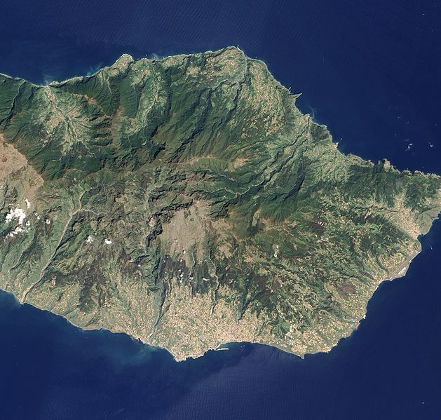
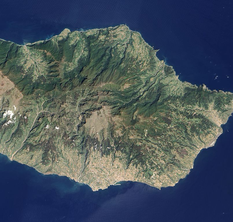
English: Detailed, true-colour image of Madeira. The image shows that deep green forest survives intact on the steep northern slopes of the island, but in the south, where terrain is gentler, the terracotta colour of towns and the light green colour of agriculture are more dominant. |
| Tanggal | |
| Sumber | NASA Earth Observatory |
| Pembuat | Jesse Allen and Robert Simmon |
Image captured by the Advanced Land Imager (ALI) on NASA’s Earth Observing-1 satellite.
Lisensi
| Berkas ini berada dalam domain publik di Amerika Serikat karena semata-mata diciptakan oleh NASA. Kebijakan hak cipta NASA menyatakan bahwa "materi NASA tidak dilindungi oleh hak cipta kecuali dicatat". (Lihat Template:PD-USGov, Halaman kebijakan hak cipta NASA atau JPL Image Use Policy.) | ||
 |
Peringatan:
|
| Annotations | This image is annotated: View the annotations at Commons |
Riwayat berkas
Klik pada tanggal/waktu untuk melihat berkas ini pada saat tersebut.
| Tanggal/Waktu | Miniatur | Dimensi | Pengguna | Komentar | |
|---|---|---|---|---|---|
| terkini | 17 Mei 2010 11.24 | | 3.147 × 2.998 (2,09 MB) | Originalwana | {{Information |Description={{en|1=Detailed, true-colour image of Madeira. The image shows that deep green forest survives intact on the steep northern slopes of the island, but in the south, where terrain is gentler, the [[:Category:Terracotta |
Penggunaan berkas
Halaman berikut menggunakan berkas ini:
Penggunaan berkas global
Wiki lain berikut menggunakan berkas ini:
- Penggunaan pada en.wikipedia.org
- Penggunaan pada ka.wikipedia.org
- Penggunaan pada pt.wikipedia.org