Berkas:CEM-36-Huguang-2433.jpg
Ukuran pratayang ini: 800 × 600 piksel. Resolusi lainnya: 320 × 240 piksel | 640 × 480 piksel | 1.024 × 768 piksel | 1.280 × 960 piksel | 1.600 × 1.200 piksel.
Ukuran asli (1.600 × 1.200 piksel, ukuran berkas: 1.016 KB, tipe MIME: image/jpeg)
Ringkasan
| Deskripsi |
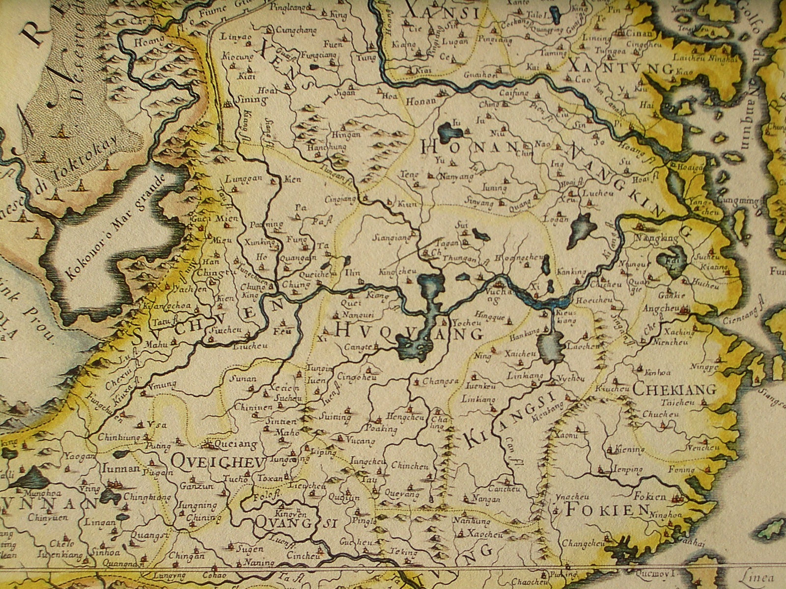
English: Northeastern fragment of a map of China (in Italian), showing the central China, in particular Huguang (Hunan + Hubei)
Italiano: "Il regno della China detto presentemente Catay e Mangin diuiso sopra le carte piu esatte nelle sue principali prouincie" |
| Tanggal | Originally published 1682; the copy at HKUST is a 1689 reprint. |
| Sumber |
English: An antique map from the Special Collection "China in Maps" of the Hong Kong University of Science and Technology Library, reproduced by the HKUST Library in the book "China in European Maps", Hong Kong, 2003. ISBN 962-86403-9-9.
Русский: Старинная карта из специальной коллекции Библиотеки Гонконгского научно-технического университета. Опубликована этой библиотекой в книге "China in European Maps" (Китай на европейских картах), Гонконг, 2003. ISBN 962-86403-9-9, тиражом 1000 экз. См. также каталог выставки, Special Collection "China in Maps".
. Fragment of Plate 36: "Il regno della China detto presentemente Catay e Mangin diuiso sopra le carte piu esatte nelle sue principali prouincie" |
| Pembuat | Giacomo Cantelli (1643-1695), Giovanni Giacomo de Rossi (1627-1691) |
| Versi lainnya |
Entire map:  |
Lisensi
|
Ini adalah suatu perbanyakan fotografis dari sebuah karya seni dua dimensi. Karya seni tersebut berada pada domain publik karena alasan berikut:
Posisi resmi Wikimedia Foundation adalah bahwa "faithful reproductions of two-dimensional public domain works of art are public domain, and that claims to the contrary represent an assault on the very concept of a public domain". Untuk detilnya, lihat Commons:When to use the PD-Art tag.
Oleh karena itu, perbanyakan fotografis ini juga dianggap berada pada domain publik. Mohon diperhatikan bahwa hukum lokal mungkin saja melarang atau membatasi penggunaan kembali berkas ini di wilayah hukum anda. Lihat Commons:Reuse of PD-Art photographs. | ||||
Riwayat berkas
Klik pada tanggal/waktu untuk melihat berkas ini pada saat tersebut.
| Tanggal/Waktu | Miniatur | Dimensi | Pengguna | Komentar | |
|---|---|---|---|---|---|
| terkini | 18 Maret 2009 04.47 | | 1.600 × 1.200 (1.016 KB) | Vmenkov | {{Information |Description={{en|1=Northeastern fragment of a 1682 map of China (in Italian), showing the central China, in particular Huguang (Hunan + Hubei)}} {{it|1="Il regno della China detto presentemente Catay e Mangin diuiso sopra le carte piu esatt |
Penggunaan berkas
Halaman berikut menggunakan berkas ini:
Penggunaan berkas global
Wiki lain berikut menggunakan berkas ini:
- Penggunaan pada az.wikipedia.org
- Penggunaan pada ba.wikipedia.org
- Penggunaan pada cs.wikipedia.org
- Penggunaan pada en.wikipedia.org
- Penggunaan pada fr.wikipedia.org
- Penggunaan pada it.wikipedia.org
- Penggunaan pada la.wikipedia.org
- Penggunaan pada no.wikipedia.org
- Penggunaan pada pl.wikipedia.org
- Penggunaan pada ru.wikipedia.org
- Penggunaan pada sv.wikipedia.org
- Penggunaan pada vi.wikipedia.org