Berkas:Map of the United Provinces from The Imperial Gazetteer of India (1907-1909).jpg
Ukuran pratayang ini: 505 × 599 piksel. Resolusi lainnya: 202 × 240 piksel | 405 × 480 piksel | 1.000 × 1.186 piksel.
Ukuran asli (1.000 × 1.186 piksel, ukuran berkas: 427 KB, tipe MIME: image/jpeg)
.jpg)
jai jaat
Ringkasan
| Deskripsi |
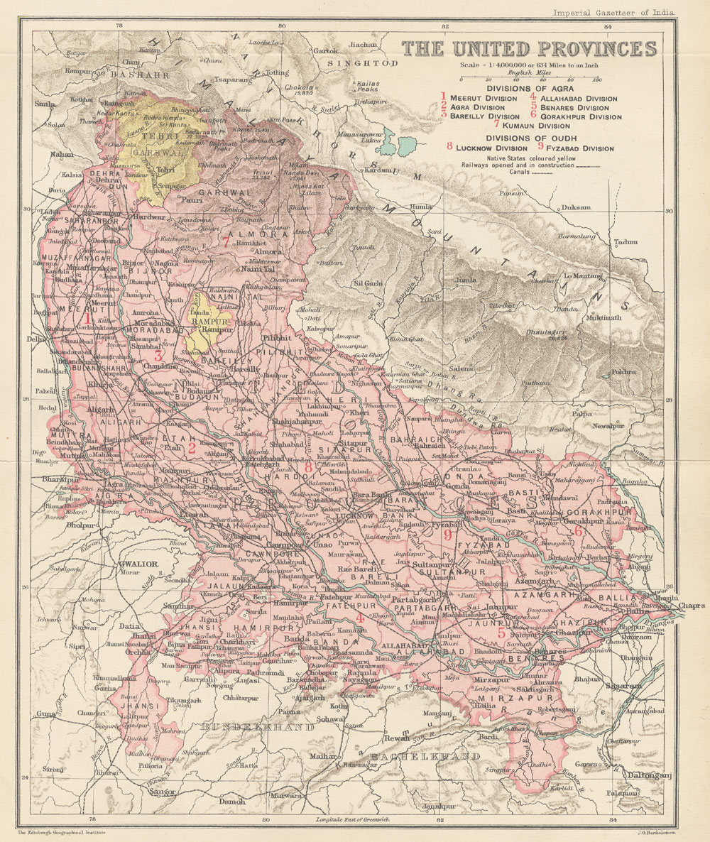
English: Map of United Provinces from The Imperial Gazetteer of India Volume 24, opposite page 250. New edition, published under the authority of His Majesty's Secretary of State for India in Council. Oxford: Clarendon Press, 1907-1909.
Scale: 1:6,000,000. 1 in. to 94.6 miles. Divisions of Agra: 1. Meerut Division, 2. Agra Division, 3. Bareilly Division, 4. Allahabad Division, 5. Benares Division, 6. Gorakhpur Division, 7. Kumaun Division. Divisions of Oudh: 8. Lucknow Division, 9. Fyzabad Division. |
| Tanggal | 1907 - 1909 |
| Sumber | http://dsal.uchicago.edu/maps/gazetteer/index.html |
| Pembuat | John G. Bartholomew |
Lisensi
The author died in 1920, so this work is in the public domain in its country of origin and other countries and areas where the copyright term is the author's life plus 100 years or fewer. | |
| Berkas ini telah diidentifikasi bebas dari pembatasan menurut hukum hak cipta termasuk semua hak terkait dan relevan. | |
Riwayat berkas
Klik pada tanggal/waktu untuk melihat berkas ini pada saat tersebut.
| Tanggal/Waktu | Miniatur | Dimensi | Pengguna | Komentar | |
|---|---|---|---|---|---|
| terkini | 8 Oktober 2014 06.19 | | 1.000 × 1.186 (427 KB) | Co9man | User created page with UploadWizard |
Penggunaan berkas
Halaman berikut menggunakan berkas ini:
Penggunaan berkas global
Wiki lain berikut menggunakan berkas ini:
- Penggunaan pada bn.wikipedia.org
- Penggunaan pada ca.wikipedia.org
- Penggunaan pada de.wikipedia.org
- Penggunaan pada en.wikipedia.org
- Penggunaan pada fr.wikipedia.org
- Penggunaan pada hi.wikipedia.org
- Penggunaan pada it.wikipedia.org
- Penggunaan pada mr.wikipedia.org
- Penggunaan pada pl.wikipedia.org
- Penggunaan pada pnb.wikipedia.org
- Penggunaan pada ru.wikipedia.org
- Penggunaan pada simple.wikipedia.org
- Penggunaan pada ta.wikipedia.org
- Penggunaan pada ur.wikipedia.org
- Penggunaan pada www.wikidata.org
.jpg)